


Ground-level intelligence with millimeter accuracy
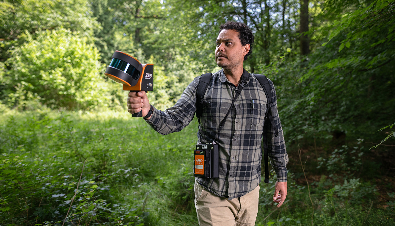
High-density,
high-resolution scans
Our terrestrial LiDAR systems - equipped with state-of-the-art sensors - capture millions of 3D data points per second. The result? Ultra-detailed point clouds reveal the full complexity of your forest.
Data you can trust,
faster than ever
Our workflows are optimized to process large-scale scans in record time. Using proprietary algorithms and AI-assisted filtering, we eliminate noise and deliver clean, classified data faster - so your teams can move from scan to strategy without delay.
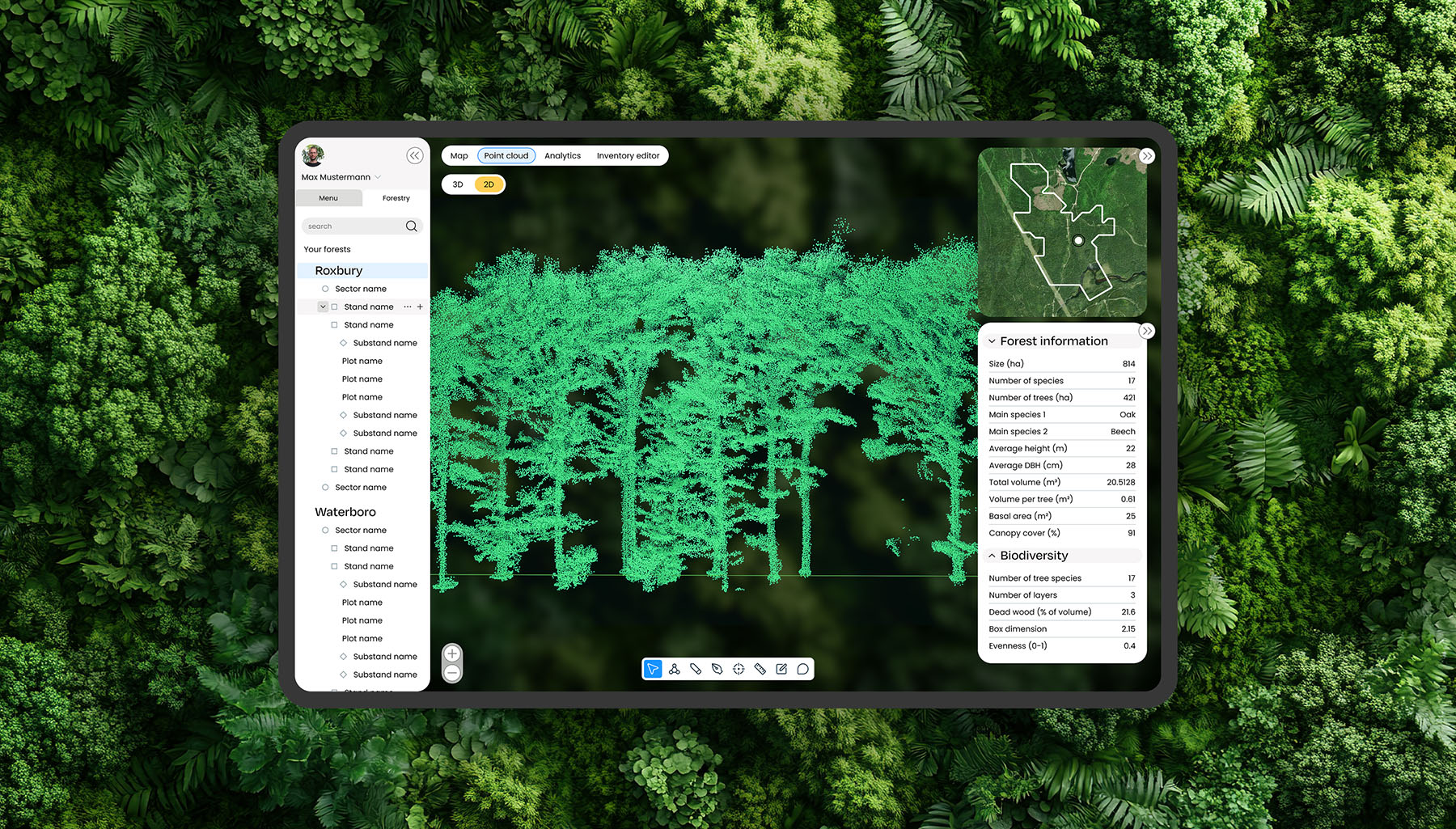
Built for analysis,
built for action
Paired with our analytics platform, LiDAR becomes more than just forest measurement - it becomes a tool for prediction. Monitor environmental change, detect anomalies, calculate volumes, or simulate growth scenarios -all from your desktop or mobile device.
Our impact in numbers
4~6
times faster
than traditional
inventory
inventory
98%
accuracy
in volume
modelling estimate
modelling estimate
© 2026 | All rights reserved